Home Blog Page 29

Kinondo Dive Site- Diani

Advanced Diani dive site · Kenya
All dive sites ↗

Kinondo.

A southern pinnacle.
Coral gardens and an eastern drop-off.
Explore the edge of Diani.
Book a Diani dive ↗
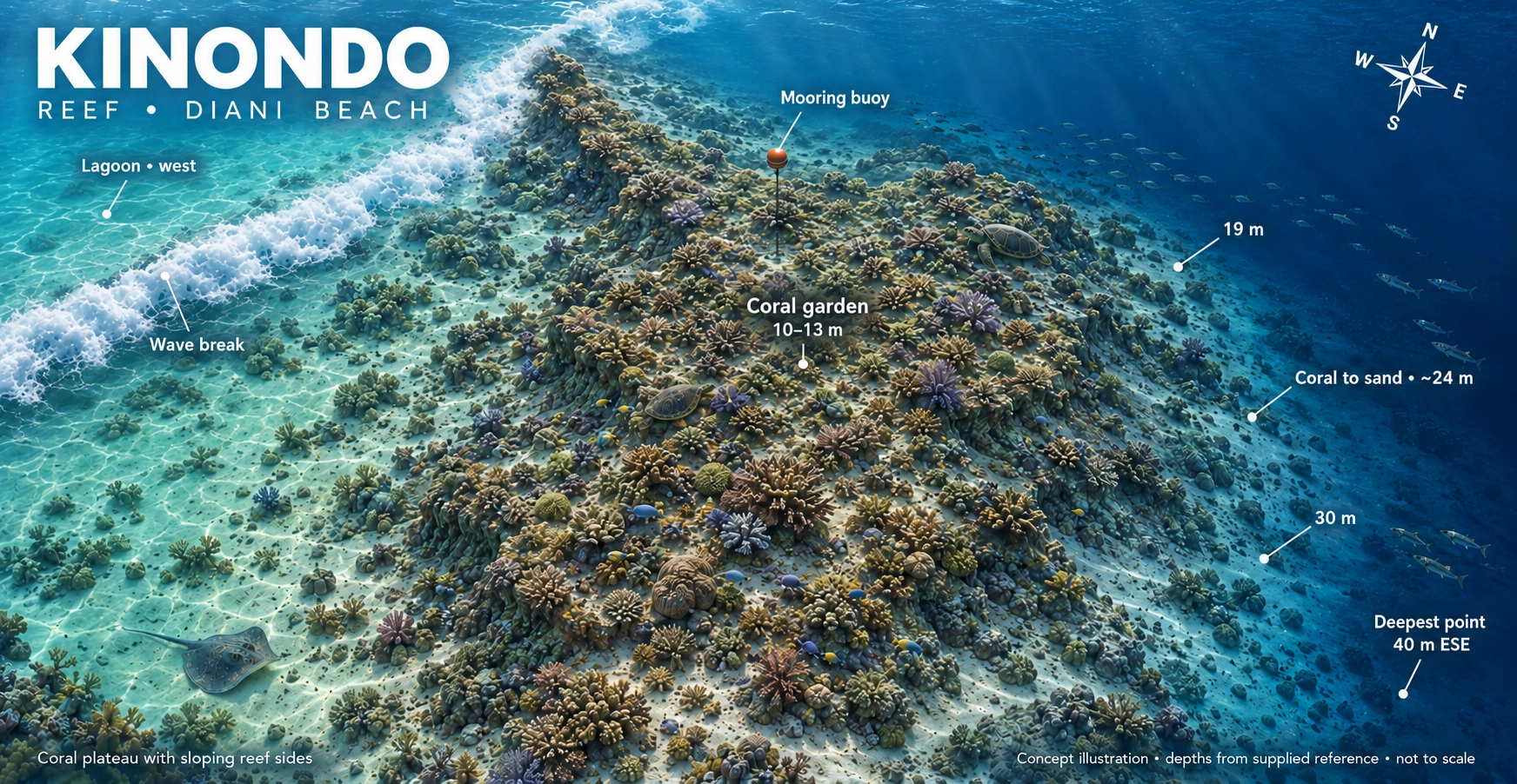
Kinondo reef concept map showing the pinnacle, coral plateau, reef slope, eastern drop-off and depth markers. Not to scale.
Your underwater playgroundPinnacle reef · Coral plateau · Eastern drop-offExplore full-size map ↗

Concept illustration, not to scale. The eastern drop-off reaches approximately 40m; your dive route and maximum depth are set for your certification, experience and the day’s conditions.

The experienceAdvanced siteCertification and experience required
Site profileDrop-off to ≈40mYour dive stays within your limits
The boat ride≈ 30 minutesAt the southern end of Diani
The starting pointShallow mooringsBest with mild or no current
Follow the reef   ✳   Find the little things   ✳   Dive Kinondo
Southern Diani

A peaceful reef with a dramatic side

Kinondo lies south of Galu, away from the busiest sections of Diani Beach. Its more remote position creates a calm and intimate reef experience when conditions are suitable.

The reef begins at approximately eight metres and includes a broad coral plateau at around 12 metres. Gentler sections slope towards sand and coral bommies near 18 metres, while the eastern side drops into much deeper water.

1
Large pinnacle reef A broad reef structure provides different routes and depths.
2
Coral plateau at approximately 12m Explore hard corals, soft corals and colourful sea fans.
3
Eastern drop-off The dramatic reef edge descends towards a maximum site depth of 40m.
Scuba diver exploring a coral reef
Two sides of one reef Relaxed coral gardens meet the excitement of deeper blue water.
Understand the profile

From plateau to drop-off

Kinondo’s shallow moorings provide access to the coral plateau. The dive can then follow the reef’s gentler sections or move towards the deeper eastern edge when conditions, certification and experience allow.

Although the site reaches approximately 40 metres, this does not mean every dive goes to that depth. Your guide will set a maximum depth appropriate for the group.

Depth is not the objective. Remain within your certification, training, experience, gas plan and the limits established during the dive briefing.
8m Reef begins
12m Coral plateau
18m Sand and bommies
40m Maximum site depth
Watch before you dive

Kinondo dive briefing

Watch the original Ocean Tribe briefing for an introduction to Kinondo’s pinnacle, plateau and eastern drop-off.

ℹ️ The video provides a general site overview. Your in-person briefing will cover the day’s current, visibility, entry point, route, depth limit, gas plan and emergency procedures.
Why dive Kinondo?

Remote, varied and full of contrast

Kinondo combines healthy coral habitat with deeper topography and opportunities to see both small reef life and larger passing fish.

🪸

Coral gardens

Staghorn coral, brain coral, soft corals and sea fans cover the shallower reef and plateau.

↘️

Changing topography

The route can move from shallow coral to sand, bommies and the dramatic eastern drop-off.

🌊

A quieter reef

Its southern location can mean fewer divers and a calmer, more intimate experience with the reef.

What might you see?

Life across the reef

Search the coral, watch the sand and remember to look into the blue around the reef edge.
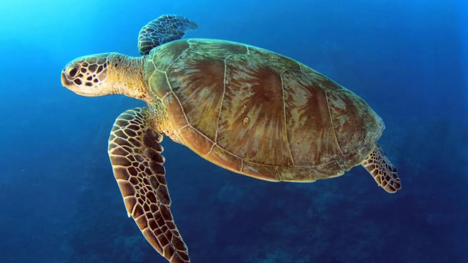
Green turtle

Turtles and rays

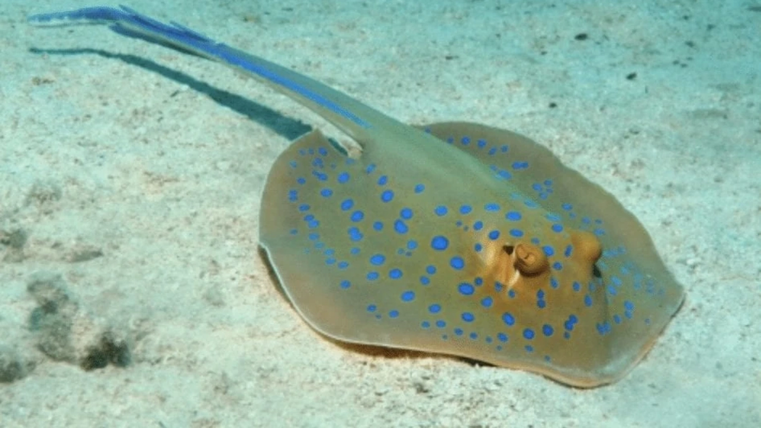
Turtles may rest on sandy ledges while blue-spotted stingrays can hide partially beneath the sand.
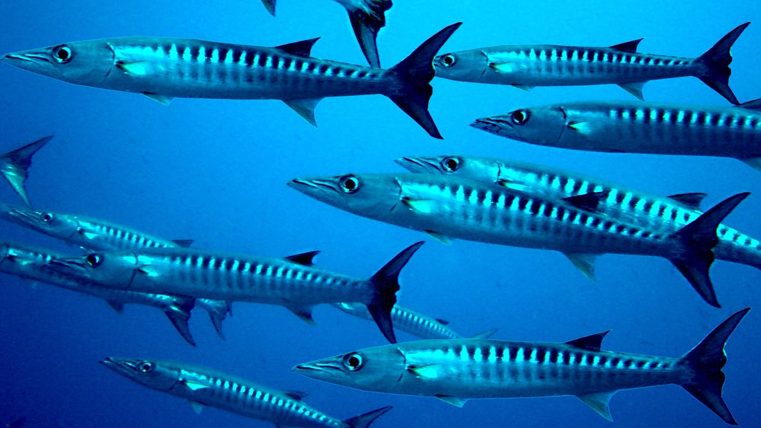
Barracuda

Schooling fish

Snapper, goatfish, fusiliers, red-tooth triggerfish and barracuda may move around the pinnacle.
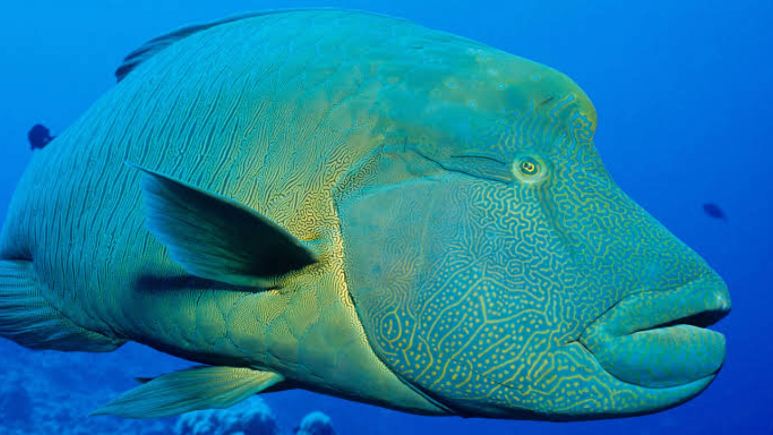
Napoleon wrasse

Reef hunters

Watch for groupers, moray eels, crocodile fish, octopus and Napoleon wrasse.
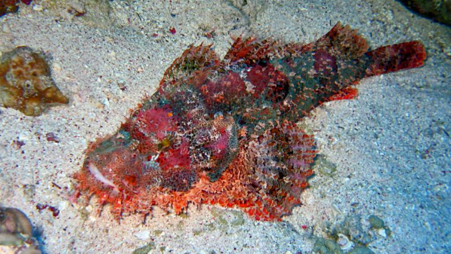
Bearded scorpionfish

Macro discoveries

Nudibranchs, mantis shrimp and well-camouflaged scorpionfish reward patient searching.

Marine-life encounters are wild and cannot be guaranteed. Conditions and the planned route determine which areas of Kinondo can be explored.
Great for reef photography Capture coral scenes, schooling fish and small camouflaged residents.
Explore responsibly

Protect Kinondo’s coral gardens

Kinondo’s hard and soft coral provides food, shelter and hunting habitat for the reef’s marine life. Careful diving helps protect this environment for future visitors.

✓ Maintain neutral buoyancy and avoid contact with coral or the seabed.
✓ Streamline your equipment so gauges and alternate air sources do not drag across the reef.
✓ Use careful fin techniques near sand and delicate coral.
✓ Give wildlife space and never chase or touch marine animals.
Kinondo QR code and dive-site details for MySSI
Save the dive

Log Kinondo in MySSI

Record the dive you actually completed rather than Kinondo’s maximum site depth. Use your dive computer for your personal depth, time and temperature information.

✓ Record your actual maximum depth and dive time.
✓ Add the route, conditions and marine life encountered.
✓ Note whether you explored the plateau or deeper reef edge.
✓ Ask your dive professional to verify the dive if required.
Find dive sites in MySSI
Before diving Kinondo

Prepare for the reef edge

🎓

Check your certification

The planned depth must remain within your certification, recent experience and the limits set by your dive professional.

🧭

Listen to the route briefing

The guide will explain the mooring, direction of travel, current, turning point and planned ascent procedure.

⏱️

Monitor depth and gas

Deeper water can increase gas consumption and reduce no-decompression time, so check your instruments regularly.

Keep exploring

Explore our local reefs and wreck. Swipe through the maps or use the arrows to discover all 11 sites.
Ready for Kinondo?

Explore Diani’s southern reef edge

Tell Ocean Tribe your certification, recent diving experience and preferred depth. The final dive sites and routes are chosen for the conditions and experience of the group.
Kinondo · Scroll across the map on mobile
Full-size Kinondo reef concept map with pinnacle, coral plateau, depth markers and eastern drop-off. Not to scale.

Dzinani Dive Site- Diani

Diani dive site · Kenya
All dive sites ↗

Dzinani.

Three coral islands.
A whole world beneath the surface.
Meet your next underwater adventure.

Book a Diani dive ↗
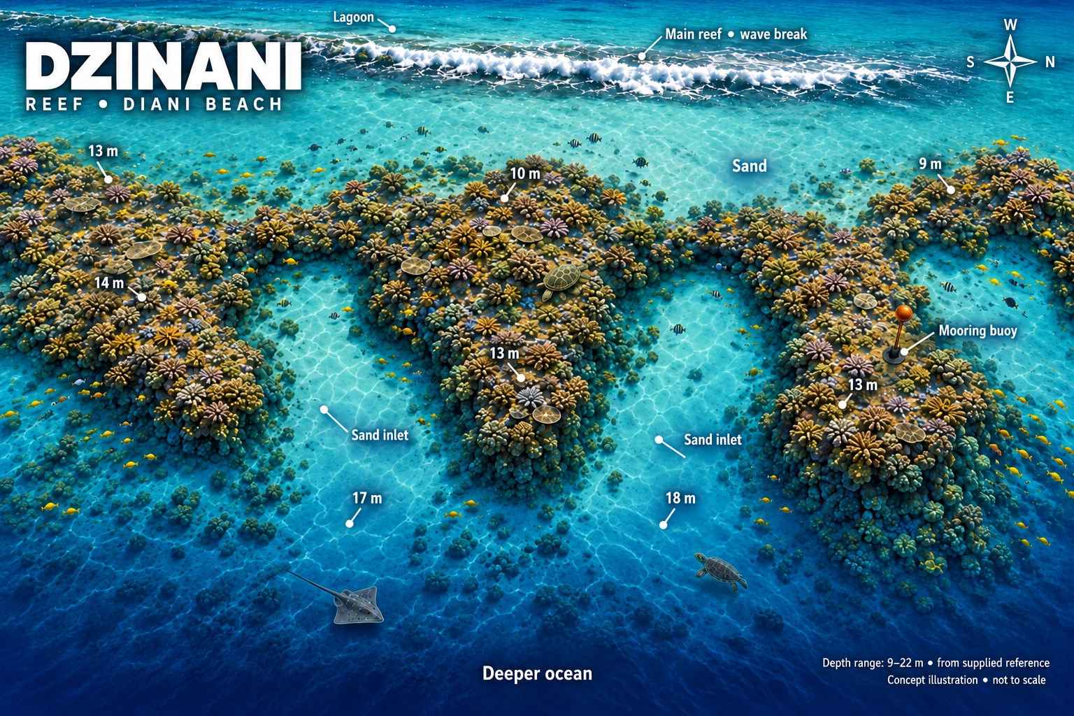
Dzinani reef concept map: three coral islands separated by sandy inlets, depth markers, mooring buoy, lagoon and compass. Concept illustration, not to scale.
Your underwater playgroundCoral islands · Sandy inlets · Reef residentsExplore full-size map ↗

Concept illustration, not to scale. Map shows 9–22m; the previous site profile lists 20m maximum. Your guide confirms the planned depth and route for your group and the day’s conditions.

The experienceBeginner friendlyProfile adapted to the group
Site profile20m maximum**Planned depth confirmed by your guide
The boat ride≈ 25 minutesFrom Ocean Tribe
The starting pointMooring buoyNot normally a drift dive
Follow the reef   ✳   Find the little things   ✳   Dive Dzinani
Three coral islands

A reef made for exploring

Dzinani lies towards the southern end of Diani’s local dive sites, approximately level with Kinondo on land. Its three coral islands create a varied underwater route with reef edges, sandy spaces and plenty of areas to investigate.

The site is reached using a mooring buoy and is not normally planned as a drift dive. Its accessible profile makes it a great option for beginner divers while still offering plenty to interest experienced photographers and macro-life enthusiasts.

1
Easy-to-follow reef structure Three separate coral formations create a varied route.
2
Excellent wildlife variety Look for reef fish, turtles, rays and unusual macro species.
3
A relaxed local boat dive Approximately 25 minutes from the Ocean Tribe dive centre.
Dzinani coral reef dive site in Diani, Kenya
Keep your eyes open Some of Dzinani’s best discoveries are hiding in plain sight.
Watch before you dive

Dzinani dive briefing

See the reef layout and learn how the dive is normally approached before heading out on the boat.

ℹ️ This video provides an overview of the site. Your Ocean Tribe guide will still give a complete in-person briefing based on the day’s conditions and planned route.
The underwater journey

What the dive may feel like

The exact route changes with conditions, but Dzinani’s three coral formations provide a natural progression through the site.

⚓

Descend at the mooring

Complete your buoyancy check and settle into the dive beside the reef.

🪸

Explore the coral islands

Follow the reef edges while your guide searches for marine life hiding among the coral.

🔍

Slow down and look closer

Dzinani rewards patient divers with frogfish, ribbon eels and other small reef specialists.

Who lives here?

Dzinani’s reef residents

Wildlife sightings are always natural and cannot be guaranteed, but these are some of the animals associated with the site.

Green turtle swimming over a reef

Green turtles

Watch for turtles resting near the reef or cruising between the coral islands.

Blue-spotted stingray

Blue-spotted rays

Look carefully across sandy patches and beneath sheltered reef edges.

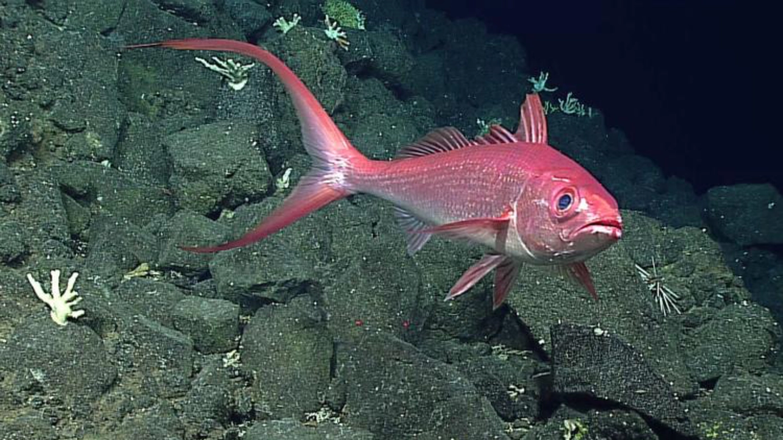
Red snapper

Colourful reef fish

Red snapper and a lively mixture of tropical fish move around the coral.

Frogfish camouflaged against coral

Macro favourites

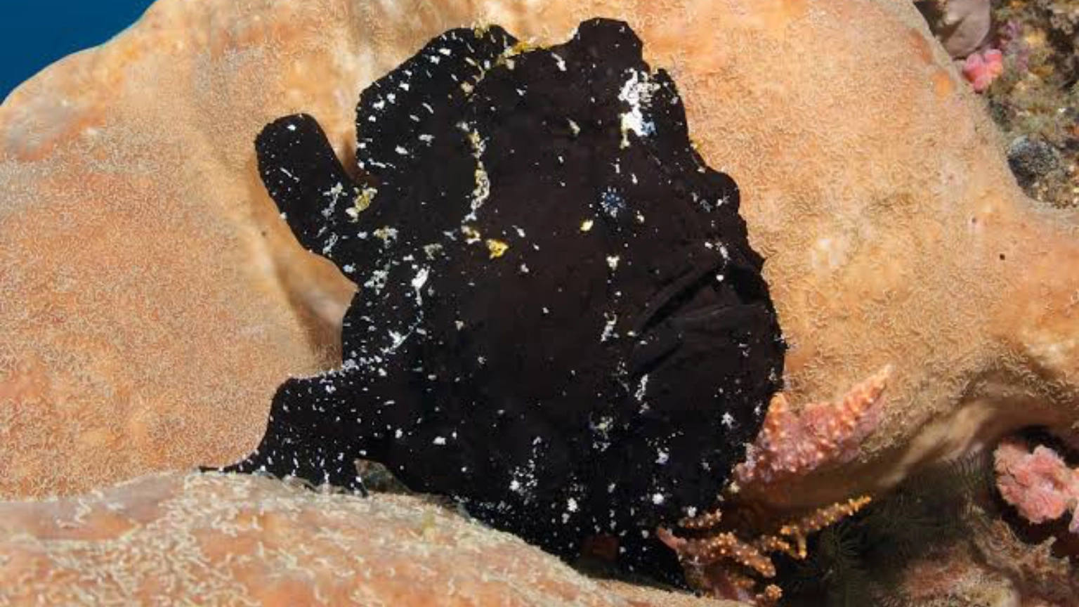
Frogfish, ribbon eels, leaf fish and pegasus or dragonfish may be found.

Dzinani dive-site information for logging the dive
Save the memory

Log Dzinani in MySSI

After your dive, record the site, maximum depth, dive time and wildlife you encountered in your MySSI digital logbook.

✓ Confirm your actual maximum depth with your dive computer.
✓ Add the marine life you personally encountered.
✓ Ask your dive professional to verify the dive if required.
Find dive sites in MySSI
Prepare for Dzinani

Make the most of your dive

1

Fine-tune your buoyancy

Comfortable buoyancy lets you move gently around the reef and observe marine life without disturbing the coral.

2

Look beyond the obvious

Check sheltered ledges, coral edges and sandy areas rather than swimming quickly past the smaller details.

3

Follow your guide

Local guides know the reef’s hiding places and will adapt the route to the conditions and experience of the group.
Keep exploring

Explore our local reefs and wreck. Swipe through the maps or use the arrows to discover all 11 sites.

Ready to explore?

Add Dzinani to your Diani adventure

Tell the Ocean Tribe team your certification and recent dive experience. They will choose the most suitable sites for the group and conditions.

Dzinani · Scroll across the map on mobile
Full-size Dzinani reef concept map with coral islands, depth markers and mooring buoy. Not to scale.

Mwanyaza Dive Site- Diani

Diani dive site · Kenya
All dive sites ↗

Mwanyaza.

A long, colourful fringing reef.
Turtles, rays and tiny discoveries.
Go with the flow along Diani.

Book a Diani dive ↗
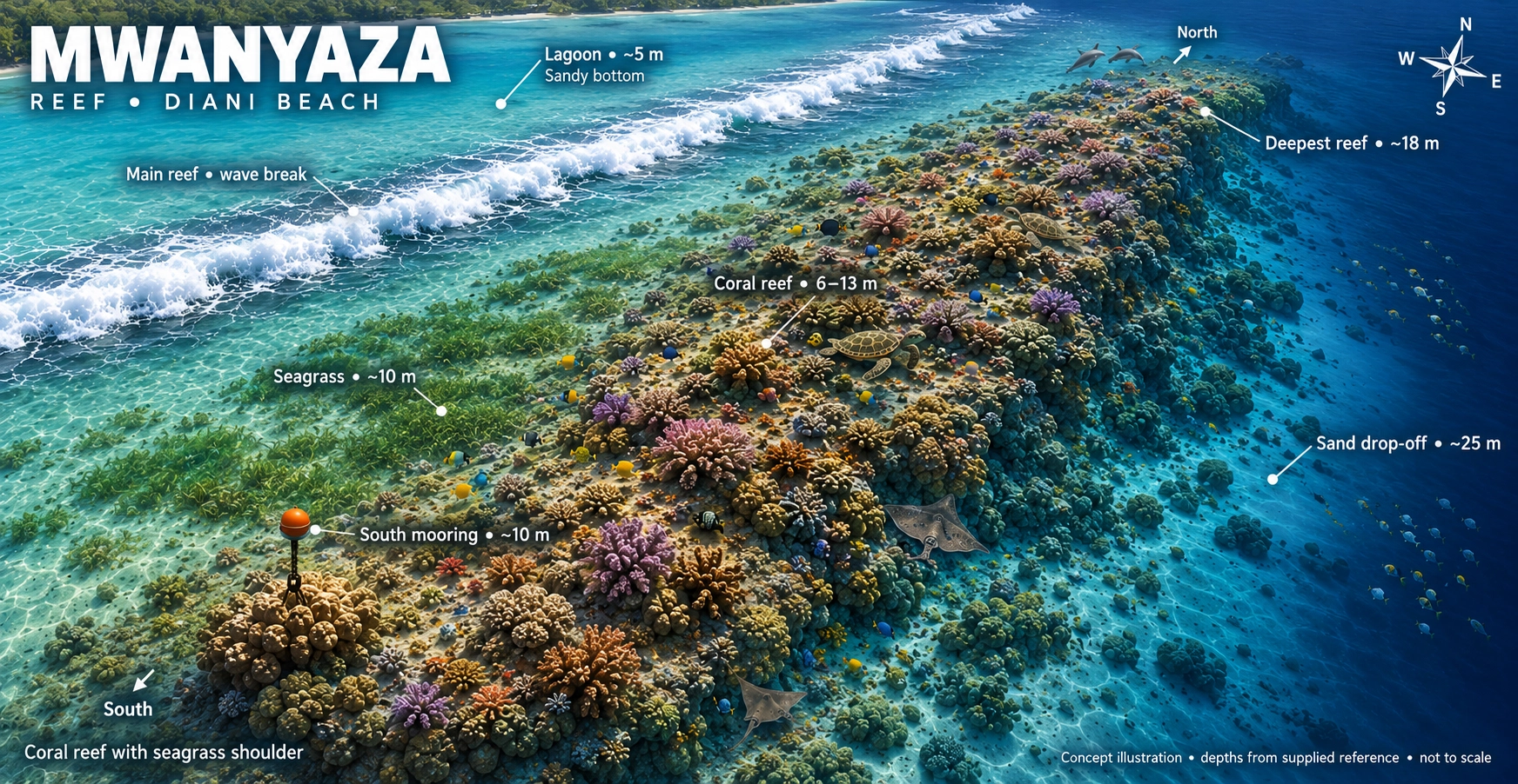
Mwanyaza reef concept map showing its long fringing reef, coral formations, sandy areas and depth markers. Not to scale.
Your underwater playgroundFringing reef · One-way drift · Reef residentsExplore full-size map ↗

Concept illustration, not to scale. The map marks a sandy drop-off around 25m; the supplied dive-site profile runs from approximately 8m to 20m. Your guide confirms the drift direction, entry point and planned depth for the day’s conditions.

The experienceBeginner friendlyProfile adapted to the group
Site profile≈ 20m maximumMost coral around 9–18m
The boat ride≈ 10 minutesFrom Ocean Tribe
The dive styleOne-way driftBoat pickup after the ascent
Follow the reef   ✳   Find the little things   ✳   Dive Mwanyaza
A long fringing reef

More reef, more time to explore

Mwanyaza is a vibrant inshore reef located approximately level with Pinewood Hotel. The reef begins at around eight metres and slopes gently towards a maximum depth of approximately 20 metres.

Its long coral profile is normally explored as a one-way drift dive, allowing divers to move with the water rather than returning to the original mooring.

1
Long continuous reef Coral formations extend across a wide area between approximately 9–18m.
2
Gentle one-way drift When conditions allow, the current provides an easy journey along the reef.
3
Colour and variety Healthy coral, schooling fish, turtles and macro life reward patient divers.
Scuba diver exploring a coral reef
Go with the flow Relax, maintain your position with the group and let the reef pass beneath you.
How the dive works

What is a one-way drift dive?

Rather than swimming back to the starting point, divers follow the reef in the direction of the current. The boat collects the group after the ascent at the end of the dive.

A gentle current can make the dive feel effortless, but good group awareness remains important. Stay close to your guide and buddy and avoid dropping behind while taking photographs.

The current decides the route. The dive direction, entry point and whether a drift is suitable will be confirmed during the briefing.
Entry → reef journey → pickup The boat follows the group’s bubbles and surface marker.
Watch before you dive

Mwanyaza dive briefing

Watch the original Ocean Tribe briefing for an introduction to the reef layout and normal direction of the dive.

ℹ️ This video provides a general overview. Your in-person briefing will confirm the current, entry point, planned route, group procedure, maximum depth and ascent method for the day.
Why dive Mwanyaza?

A dependable Diani favourite

Its shallow profile, healthy coral and lively fish population make Mwanyaza enjoyable for both newer and experienced divers.

🪸

Healthy coral cover

Staghorn, brain and soft corals create a colourful habitat across the long reef.

🐟

Lively fish schools

Fusiliers and snapper sweep across the reef while parrotfish, angelfish and butterflyfish feed among the coral.

⏱️

Relaxed dive profile

Much of the reef lies at moderate depth, offering time to slow down and enjoy the scenery.

Reef profile

Shallow, sloping and easy to explore

Mwanyaza begins at approximately eight metres, with much of its coral running between nine and 18 metres before the reef slopes towards a maximum depth of around 20 metres.

Your actual depth depends on the route, conditions, certification and experience of the group.

8m Top of the reef begins
9–18m Main coral reef and drift route
20m Maximum site depth
Who might you meet?

Marine life at Mwanyaza

Watch above the coral for schooling fish, scan the sand for rays and look closely for the reef’s camouflage experts.

Green turtle

Turtles

Turtles are regular visitors and may be found resting between coral heads or swimming across the reef.

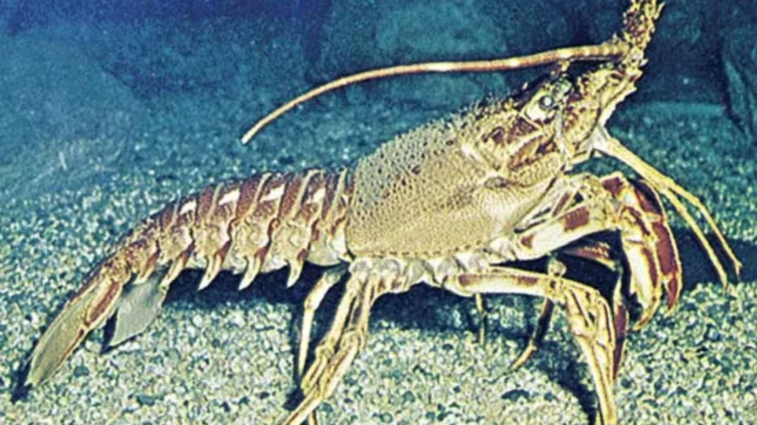
Lobster sheltering on a reef

Octopus and lobster

Search beneath ledges and inside reef crevices for octopus and lobsters sheltering from view.

Blue-spotted stingray

Blue-spotted rays

Rays may be seen resting on sand beside the reef or moving between coral formations.

Camouflaged frogfish

Macro favourites

Frogfish, ghost pipefish, nudibranchs, mantis shrimp and scorpionfish reward careful searching.

Marine-life encounters are natural and cannot be guaranteed. Stay close enough to your guide to see the smaller animals they discover.
A reef worth taking slowly Longer shallow exploration means more opportunities to notice the details.
Enjoy the journey

Make the most of the reef

Mwanyaza’s moderate depth can allow generous bottom time, but every dive remains limited by gas supply, no-decompression time, conditions and the dive plan.

✓ Stay streamlined. Secure gauges and alternate air sources before entering the water.
✓ Keep pace with the group. Avoid falling behind while stopping for photographs.
✓ Maintain neutral buoyancy. Protect the reef and avoid disturbing sand.
✓ Look in every direction. Wildlife may be above, below or out in the blue.
Mwanyaza QR code and dive-site information for MySSI
Save the dive

Log Mwanyaza in MySSI

Record your actual route, depth and dive time rather than the site’s maximum possible depth. Your dive computer provides your personal dive information.

✓ Record your actual maximum depth and total dive time.
✓ Add the current strength and direction of the drift.
✓ Record the coral and marine life encountered.
✓ Ask your dive professional to verify the dive if required.
Find dive sites in MySSI
Who is Mwanyaza for?

A reef with broad appeal

🌱

Newer divers

The moderate depth and normally gentle conditions can provide a comfortable introduction to reef and drift diving.

🎓

Training dives

Mwanyaza’s accessible reef profile can be suitable for skills, navigation and general experience-building dives.

📷

Photographers

Colourful coral, schooling fish, turtles, rays and macro life provide a variety of photographic subjects.

Keep exploring

Explore our local reefs and wreck. Swipe through the maps or use the arrows to discover all 11 sites.

Ready to drift?

Let Mwanyaza carry you along the reef

Tell Ocean Tribe your certification and recent experience. Dive sites and routes are selected according to the group, current and conditions on the day.

Mwanyaza · Scroll across the map on mobile
Full-size Mwanyaza reef concept map with fringing reef, coral formations and depth markers. Not to scale.

Galu Dive Site- Diani

Diani dive site · Kenya
All dive sites ↗

Galu.

Coral bommies. Sandy pathways.
Turtles and tiny reef discoveries.
Take your time beneath the surface.

Book a Diani dive ↗
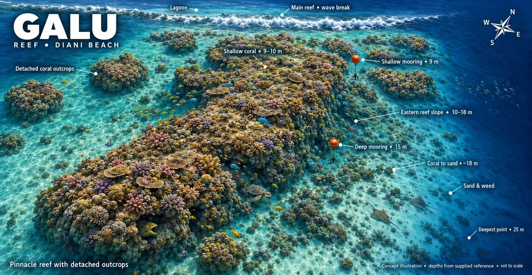
Galu reef concept map with coral outcrops, shallow and deep moorings, reef slope, sandy patches and depth markers. Not to scale.
Your underwater playgroundCoral outcrops · Sandy patches · Turtle encountersExplore full-size map ↗

Concept illustration, not to scale. Depths vary across the reef; your guide confirms the route and planned maximum depth for your certification and the day’s conditions.

The experienceBeginner friendlyProfile adapted to the group
Site profile≈ 25m maximumShallow and deeper routes
The boat ride≈ 10 minutesFrom Ocean Tribe
The entry pointsTwo mooringsShallow and deep options
Follow the reef   ✳   Find the little things   ✳   Dive Galu
Relaxed reef exploration

Galu gives you time to look closer

Located just south of Diani Beach, Galu is a colourful and accessible reef suited to a wide range of divers. The reef begins at approximately six metres before passing across a coral plateau and gently descending towards deeper sand and scattered coral bommies.

Calm conditions, varied depths and good marine-life diversity make Galu popular for relaxed fun dives, underwater photography and training dives.

1
Shallow and deeper routes The dive plan can be adapted to the group’s certification and experience.
2
Deep and shallow moorings Different entry points help the team select the best reef profile.
3
Excellent for patient divers Slow down to find turtles, rays, octopus and camouflaged macro life.
Scuba diver exploring a coral reef
The slow-dive reef Relax your pace and let Galu’s smaller details reveal themselves.
A reef for different levels

From shallow coral to deeper sand

Galu begins at around six metres, with a coral plateau at approximately ten metres. The main reef then slopes gently towards sand patches and scattered bommies around eighteen metres.

Deeper routes can reach a maximum of approximately 25 metres when suitable for the certification and experience of the divers.

Your actual route and maximum depth will be decided during the dive briefing and may change with conditions.

6m Reef begins
10m Coral plateau
18m Sand and bommies
25m Maximum depth
Watch before you dive

Galu dive briefing

Watch the original Ocean Tribe briefing for an introduction to the reef layout and the way the site is normally approached.

ℹ️ This video introduces the site but does not replace the in-person briefing. Your Ocean Tribe guide will explain the current conditions, planned route, depth limits and safety procedures on the day.
The character of Galu

Why divers enjoy this reef

A forgiving profile does not mean a boring dive. Galu combines accessible conditions with an impressive amount of marine-life variety.

🪸

Colourful coral structure

Hard and soft corals, including staghorn, brain and leather corals, provide shelter for a lively reef community.

📷

Photography friendly

Gentle profiles and a mixture of reef and sand create opportunities for wide-angle scenes and close-up marine-life photographs.

🌊

Relaxed exploration

Conditions are often calm with gentle current, making Galu suitable for training and comfortable reef dives.

Who might you meet?

Galu’s reef residents

Look above the reef, beneath the ledges and across the sand. Different parts of Galu reward different styles of observation.

Green turtle

Turtles

Galu is regularly visited by turtles, which may be seen resting beneath ledges or gliding over the reef.

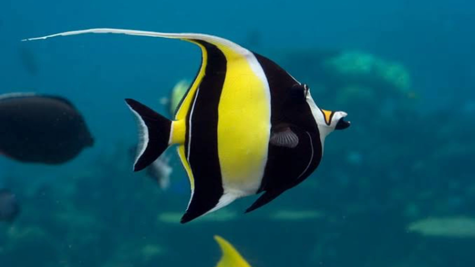
Moorish idol among reef fish

Schooling fish

Yellow snapper, fusiliers and sergeant majors add movement and colour above the coral.

Blue-spotted stingray

Sand and reef hunters

Look for reef octopus, blue-spotted rays, crocodile fish, moray eels and occasional guitar rays.

Guitar ray

Small details & surprises

Leaf fish, ghost pipefish, nudibranchs, ribbon eels and dwarf lionfish reward careful searching. An occasional guitar ray is a special bonus.

Marine-life encounters are natural and cannot be guaranteed. Larger seasonal visitors, including whale sharks, are possible but should always be considered a very special bonus.
Wide-angle or macro? Galu gives underwater photographers opportunities for both.
Bring your camera

A natural underwater studio

Galu’s gentle reef profile allows photographers to settle into the dive and concentrate on composition. Coral scenery, schooling fish and passing turtles can provide strong wide-angle subjects.

The reef’s smaller residents are equally rewarding. Search slowly around coral heads, sheltered ledges and the edges of sandy patches.

✓
Move slowly. Careful finning helps avoid disturbing sand and marine life.
✓
Maintain neutral buoyancy. Protect the reef and create steadier photographs.
✓
Follow your guide. Local knowledge helps reveal well-camouflaged subjects.
Galu dive-site details for logging the dive in MySSI
Save the dive

Log Galu in MySSI

Record the route you actually completed rather than the site’s maximum possible depth. Your dive computer provides your personal depth, bottom time and water-temperature information.

✓ Record your actual maximum depth and total dive time.
✓ Add the marine life you personally encountered.
✓ Note which Galu mooring and reef route were used.
✓ Ask your dive professional to verify the dive if required.
Find dive sites in MySSI
Who is Galu for?

One reef, several ways to enjoy it

🌱

Newer divers

The shallow sections and generally relaxed profile can help newer divers build confidence and enjoy the reef.

🎓

Training dives

Galu is commonly used for Open Water training and other dives where a flexible range of depths is useful.

📸

Experienced observers

Photographers and marine-life enthusiasts can spend the dive searching for Galu’s more elusive reef residents.

Keep exploring

Explore our local reefs and wreck. Swipe through the maps or use the arrows to discover all 11 sites.

Ready to dive Galu?

Slow down and let the reef come alive

Tell the Ocean Tribe team your certification, recent experience and interests. The final dive sites are selected for the group and the conditions on the day.

Galu · Scroll across the map on mobile
Full-size Galu reef concept map with coral outcrops, depth markers and two moorings. Not to scale.

Tiwi Wall Dive Site- Diani

Wall & coral gardens · Diani, Kenya
All dive sites ↗

Tiwi Wall.

Sunlit coral gardens.
Overhangs, a tunnel and the wall.
Follow the reef into a different world.

Book a Diani dive ↗
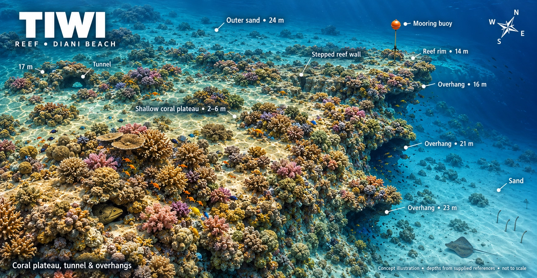
Tiwi reef concept map showing a shallow coral plateau, stepped reef wall, tunnel, overhangs, mooring buoy and sandy bottom. Not to scale.
Your underwater playgroundCoral plateau · Tunnel · Reef overhangsExplore full-size map ↗

Concept illustration, not to scale. Depths vary across the reef, from the shallow coral plateau to deeper wall sections. Your guide confirms the planned depth and route for your certification and the day’s conditions.

The experienceBeginner friendlyProfile adapted to the group
Site profile≈ 25m maximumRoute adapted to certification
The boat ride≈ 45 minutesFrom Ocean Tribe
The starting pointMooring buoyNot normally a drift dive
Follow the reef   ✳   Find the little things   ✳   Dive Tiwi Wall
Where the reef changes shape

Coral gardens meet the wall

Tiwi Wall lies near the mouth of the Kongo River, beyond the main Diani reef area. A shallow coral plateau begins at approximately 5–6 metres before the site slopes into deeper water.

The reef combines hard and soft coral gardens with overhangs, a tunnel and deeper wall-like terrain. Its variety makes it useful for relaxed exploration, training and underwater photography.

1
Shallow coral plateau Bright coral gardens begin at approximately six metres.
2
Overhangs and tunnel Distinct reef features make the site fun to explore.
3
A longer boat adventure Allow approximately 45 minutes from Ocean Tribe.
From sunshine to blue water Tiwi’s changing depth gives each part of the reef a different character.
Follow the edge

The Tiwi depth journey

Your guide will choose the route and maximum depth for the conditions, certification and experience of the group.
5–6m
≈16m
25m max

Shallow coral plateau

Begin among hard and soft corals where sunlight brings out the colours of the reef.

Sloping reef and sand

Follow coral heads and sandy spaces while searching for rays, macro life and reef fish.

Overhangs and tunnel

Tiwi’s distinctive structure adds variety while the guide selects a suitable route for the group.

Deeper wall edge

Appropriately certified divers may explore deeper sections while remaining within the planned maximum depth.

Watch before you dive

Tiwi Wall dive briefing

Preview the reef layout and important features before receiving the complete live briefing from your Ocean Tribe guide.

ℹ️ The video provides a general site overview. Conditions and visibility can change, so always follow the in-person briefing given on the day.
See the complete site

Tiwi Wall profile

Mooring buoys provide access to the reef. The dive can remain within the shallower coral gardens or continue towards deeper terrain, depending on certification and conditions.

Experience Beginner friendly routes
Maximum depth 25 metres
Plateau About 5–6 metres
Water type Salt water
Dive style Mooring reef dive
Boat journey About 45 minutes
Why dive Tiwi?

More than just a wall

🪸

Coral gardens

Staghorn, brain and soft corals create colourful shallow habitats.

⌒

Overhangs

Sheltered reef sections provide hiding places for fish and macro life.

◉

Reef tunnel

A distinctive tunnel adds another memorable feature to the site.

↘

Deeper edge

The reef changes character as it slopes away from the shallow plateau.

Timing matters

Best when the river runs clear

Tiwi Wall lies close to the mouth of the Kongo River. After heavy rainfall, river runoff can reduce visibility around the site.

Drier periods can offer clearer conditions, allowing divers to appreciate the coral gardens, wall features and fish life more fully. Ocean Tribe checks local conditions before selecting Tiwi.

Tiwi is not automatically scheduled every day. The team selects it when conditions make the longer boat journey worthwhile.
Relaxed reef potential High
Training suitability High when calm
Visibility sensitivity Seasonal
What might you see?

Marine life at Tiwi Wall

Wildlife encounters are natural and can never be guaranteed.

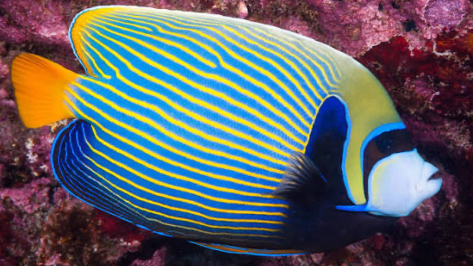
Emperor angelfish

Reef fish

Fusiliers, sergeant majors, yellow snapper, parrotfish and angelfish.

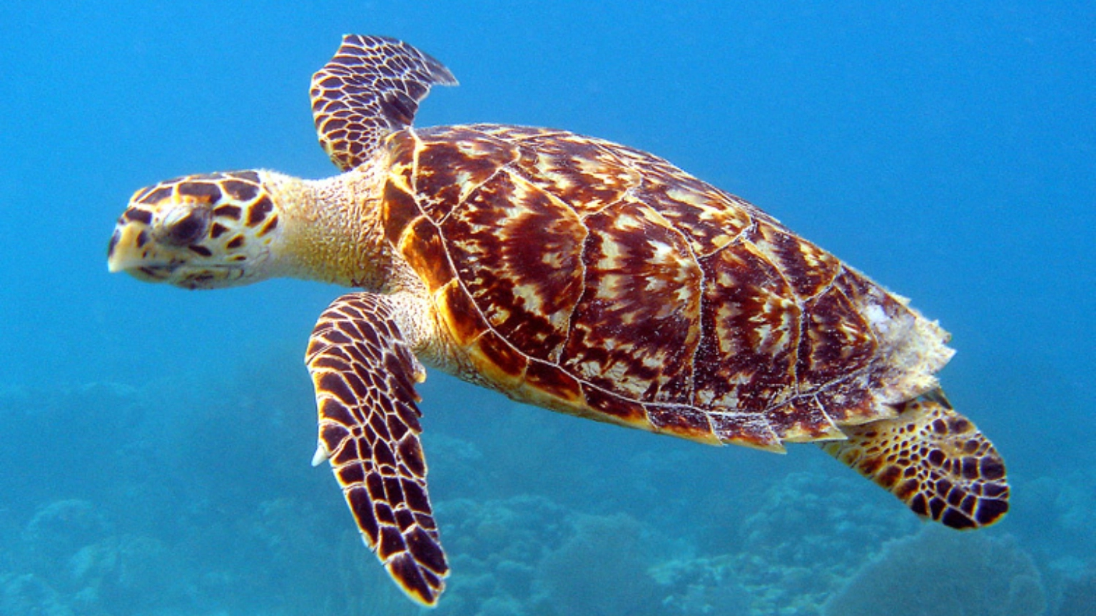
Hawksbill turtle

Hawksbill turtles

Turtles may occasionally pass through the coral gardens.

Blue-spotted stingray

Blue-spotted rays

Look across sandy areas for rays resting near coral heads.

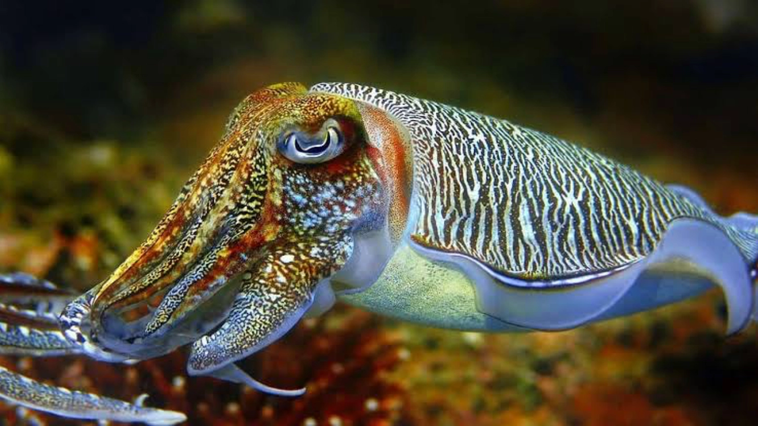
Cuttlefish

Cuttlefish

Watch for changing colour and texture around the reef.

Look closer: nudibranchs, flatworms and pipefish hide in sheltered reef sections. Sweetlips may gather beneath ledges or around sheltered coral.

Watch the blue: keep an eye beyond the reef for barracuda cruising in open water. Tiwi’s hard and soft corals create colour from the shallow plateau downwards.

Prepare for Tiwi

Make the most of the wall

1

Stay within your depth

The reef offers different depth options. Follow the route appropriate for your certification.

2

Protect the coral

Maintain good buoyancy around the plateau, overhangs and tunnel.

3

Follow the live briefing

Visibility and conditions near the river can change, so the day’s briefing takes priority.

Keep exploring

Explore our local reefs and wreck. Swipe through the maps or use the arrows to discover all 11 sites.

Ready for Tiwi Wall?

Take the longer ride to a different reef

Tell the Ocean Tribe team your certification and recent experience. Tiwi will be selected when the visibility and conditions are suitable.

Tiwi Wall · Scroll across the map on mobile
Full-size Tiwi Wall reef concept map with coral plateau, tunnel, overhangs, depth markers and mooring buoy. Not to scale.

Mwanamoji Dive Site- Diani

Diani dive site · Kenya
All dive sites ↗

Mwanamoji.

Coral gardens. Sandy pathways.
Turtles and tiny discoveries.
Let the reef set the pace.

Book a Diani dive ↗
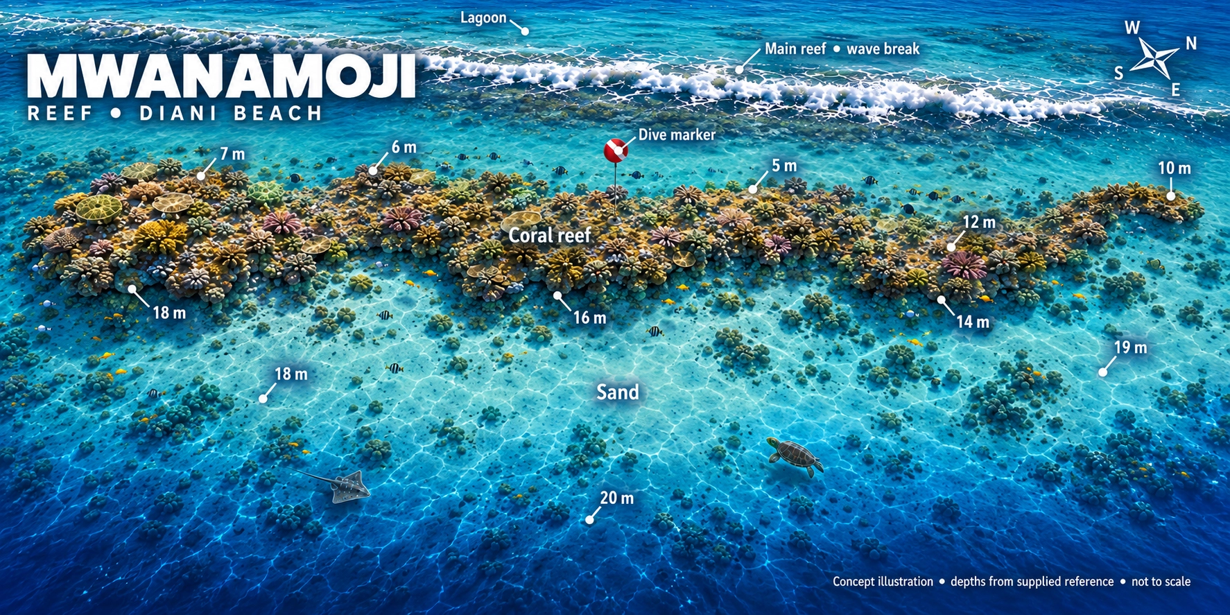
Mwanamoji reef concept map showing coral gardens, sandy patches, dive marker, lagoon and depths from 5 to 20 metres. Not to scale.
Your underwater playgroundCoral gardens · Sandy patches · Turtle territoryExplore full-size map ↗

Concept illustration, not to scale. The map shows areas from 5–20m; the supplied site profile describes the reef beginning around 10m. Your guide confirms the entry, planned depth and route for the day’s conditions and your certification.

The experienceBeginner friendlyProfile adapted to the group
Site profile≈ 20m maximumDepth adapted to the group
The boat ride≈ 25 minutesFrom Ocean Tribe
The dive styleMooring or driftRoute follows the conditions
Follow the reef   ✳   Find the little things   ✳   Dive Mwanamoji
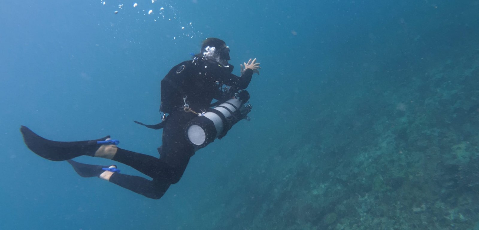
Scuba diver exploring a coral reef
Slow down Sandy patches and coral edges hide some of the reef’s best discoveries.
A relaxed underwater journey

Coral gardens with room to explore

Mwanamoji lies south of central Diani Beach, offshore from the Diani Reef and Southern Palms area. It is a long fringing reef with a coral plateau beginning at approximately 10 metres.

The reef gradually slopes over a sandy base, creating a mixture of coral gardens, bommies and open patches. Calm conditions often make it suitable for training, photography and relaxed exploration.

1
A long, varied reef Coral gardens, bommies and sandy sections in one dive.
2
Great for photography Wide reef scenes and tiny macro subjects reward patient divers.
3
Regular turtle territory Keep looking ahead as well as beneath the coral ledges.
Follow the reef

Your Mwanamoji journey

The exact route changes with conditions, but these habitats create the character of the dive.

⚓

Shallow mooring

Descend beside the reef and complete a comfortable buoyancy check.

🪸

Coral plateau

Explore staghorn, brain and soft corals around the upper reef.

🐠

Bommie trail

Follow schooling snapper and goatfish between the coral formations.

🔍

Sandy outskirts

Search for rays, octopus and unusual creatures along the reef edge.

Watch before you dive

Mwanamoji dive briefing

Preview the reef layout and key features before receiving the complete live briefing from your Ocean Tribe guide.

🪸 Notice: the long shape of the fringing reef.
〰️ Check: how the planned route follows the current.
↘️ Remember: monitor depth as the reef slopes down.
🐢 Look ahead: turtles may cruise across the reef.
Know the site

Mwanamoji at a glance

The reef begins around 10 metres and gradually slopes over sand. A shallow mooring is available, and the site may be enjoyed as a drift when conditions make that the best option.

Experience Beginner friendly
Maximum depth 20 metres
Reef begins About 10 metres
Water type Salt water
Dive style Mooring or drift
Boat journey About 25 minutes
Three habitats in one dive

Where should you look?

🪸

Coral gardens

Staghorn, brain and soft corals shelter butterflyfish, angelfish and parrotfish.

🏝️

Coral bommies

Yellow snapper and goatfish move between isolated coral formations while morays hide in crevices.

🔎

Open sand

Search carefully for blue-spotted rays, flying gurnards and octopus blending into the surroundings.

Who lives here?

Mwanamoji’s reef residents

Marine-life encounters are natural and can never be guaranteed.

Green turtle

Turtles

Mwanamoji is regularly selected for its opportunities to encounter turtles around the reef.

Blue-spotted stingray

Blue-spotted rays

Look for rays resting partly covered by sand around the reef’s outskirts.

Lobster in a reef crevice

Octopus and lobster

Check crevices for lobster and watch for octopus changing colour against the reef.

Emperor angelfish

Colourful reef fish

Yellow-striped snapper, goatfish and colourful reef fish move between the bommies.

Macro discoveries: nudibranchs, ribbon eels, pipefish and leaf scorpionfish reward careful searching. Helmet flying gurnards may be spotted moving across suitable sandy areas.

More reef colour: parrotfish, butterflyfish and angelfish bring constant colour to the reef.

Seasonal giants: whale sharks and manta rays may occasionally pass through Diani’s waters.

Whale sharks and manta rays are seasonal wild visitors. Their presence is never guaranteed and should be considered an exceptional bonus.
A flexible reef

Calm exploration or gentle drift

Mwanamoji frequently offers calm current and good visibility, particularly during the morning. Depending on the water movement, the team may plan the site as a mooring dive or a gentle drift.

The final route is selected according to conditions, certification and the experience of the group.
☀ Morning visibility Visibility can be especially enjoyable during calmer mornings.
〰 Drift possible The team may use the current to create a relaxed one-way route.
📷 Photography friendly Varied habitats offer both wide-angle and macro opportunities.
✓ Training option Suitable conditions can make Mwanamoji useful for training dives.
QR code for logging Mwanamoji in the MySSI app
Save your reef adventure

Log Mwanamoji in MySSI

Record your actual maximum depth, bottom time, route and wildlife encounters in your MySSI digital logbook.

✓ Use your dive computer for the actual depth and dive time.
✓ Record whether the dive used the mooring or a drift route.
✓ Add only the marine life you personally encountered.
Find dive sites in MySSI
Keep exploring

Explore our local reefs and wreck. Swipe through the maps or use the arrows to discover all 11 sites.

Ready to explore Mwanamoji?

Let the reef set the pace

Tell the Ocean Tribe team your certification and recent experience. Dive sites are selected according to the conditions and divers on the day.

Mwanamoji · Scroll across the map on mobile
Full-size Mwanamoji reef concept map with coral gardens, depth markers, sandy patches and dive marker. Not to scale.

Diani Dive Sites- Where Will I Dive in Diani?

Diani Dive Sites
Scuba diving in Diani, Kenya

Find your perfect dive

Drift over colourful coral gardens, search for tiny reef creatures, cruise alongside turtles or descend onto Diani’s purpose-sunk wreck. Every day brings a different underwater adventure.

🤿 Beginner to advanced Dives matched to experience
🐢 Big and small life Turtles, rays and macro
🚤 Two-dive trips Explore more in one outing
⚓ Reefs and wreck Something for every diver
A coastline full of variety

Where will you dive in Diani?

Diani’s underwater landscape ranges from gentle coral gardens to deeper walls, drift dives and the atmospheric MV Alpha Funguo wreck. The reefs support colourful fish, rays, turtles and an impressive variety of small marine life.

Ocean Tribe chooses the day’s sites according to sea conditions, diver experience and the kind of diving the group wants to enjoy. This helps provide the best and safest experience available on the day.

✓
Sites matched to your experience Relaxed reefs, deeper dives and specialist options.
✓
Local knowledge matters Conditions, currents and visibility are checked daily.
✓
No two dive days feel the same Each reef has its own structure and marine-life highlights.
Scuba diving over a coral reef at Galu in Diani, Kenya
Wild coast. Different every day. The final site choice is made using the latest local conditions.
Explore beneath Diani

Meet the dive sites

Filter the sites by diving style, then open any site for its full briefing.

Dzinani dive site in Diani All experience levels
Dive site 01

Dzinani

Maximum 20m Approx. 25 min Mooring dive

Three coral islands create an easy-going reef adventure with plenty of places to search for both colourful fish and unusual small creatures.

Look for: green turtles, blue-spotted rays, frogfish, ribbon eels and leaf fish.
View Dzinani briefing →
Galu coral reef dive site in Diani All experience levels
Dive site 02

Galu

Up to 25m Coral slope Two moorings

A flexible reef with shallow sections, a gentle coral slope and deeper options. It is ideal for training, photography and relaxed diving.

Look for: turtles, octopus, snapper, rays, scorpionfish and nudibranchs.
View Galu briefing →
Full dive-site map for Igloo in Diani All experience levels
Dive site 03

Igloo

Approx. 12–22m Coral bommies Swim-throughs

Named for its rounded coral formations, Igloo combines reef structure, swim-throughs and the remains of a former underwater observatory.

Look for: trevally, morays, turtles, nudibranchs, pipefish and occasional reef sharks.
View Igloo briefing →
Kinondo dive site in southern Diani Open Water Divers+
Dive site 04

Kinondo

Southern reef Coral terrain Local boat dive

A southern Diani reef selected when sea conditions suit the site. Its coral terrain gives divers another distinctly different local route.

Best for: exploring Diani’s southern reefs with the route adapted to the day’s conditions.
View Kinondo briefing →
Kisima Mungu advanced dive site in Diani All experience levels
Dive site 05

Kisima Mungu

Approx. 14–28m Walls and drop-offs Possible current

“God’s Well” rises from the deeper sand into a dramatic reef of walls, overhangs, sea fans and current-washed coral.

Look for: trevally, barracuda, eagle rays, morays and occasional larger pelagic visitors.
View Kisima Mungu briefing →
Full dive-site map for the MV Alpha Funguo wreck Advanced / Deep+ Divers
Dive site 06

MV Alpha Funguo

Approx. 22–30m Purpose-sunk wreck Approx. 10 min

Diani’s purpose-sunk artificial reef offers an atmospheric deeper dive around the ship’s deck, holds and superstructure.

Look for: barracuda, snapper, trevally, morays, lionfish, rays and resident macro life.
View wreck briefing →
Mwanamoji coral reef dive site in Diani All experience levels
Dive site 07

Mwanamoji

Approx. 10–22m Approx. 25 min Drift possible

Coral gardens, bommies and sandy patches make this a versatile, easy-going reef for relaxed dives and underwater photography.

Look for: rays, octopus, morays, pipefish, nudibranchs and leaf scorpionfish.
View Mwanamoji briefing →
Mwanyaza dive site in Diani All experience levels
Dive site 08

Mwanyaza

Approx. 8–20m Approx. 10 min Drift possible

A long fringing reef with shallow sections and gentle profiles, offering comfortable dives and the potential for generous bottom time.

Look for: turtles, rays, octopus, frogfish, ghost pipefish and colourful reef fish.
View Mwanyaza briefing →
Full dive-site map for Tiwi Wall All experience levels
Dive site 09

Tiwi Wall

Maximum 25m Approx. 45 min Sheltered reef

A reef plateau with coral gardens, overhangs and a tunnel. Tiwi can provide a calm, scenic dive when local visibility is suitable.

Look for: turtles, rays, sweetlips, cuttlefish, barracuda and nudibranchs.
View Tiwi Wall briefing →
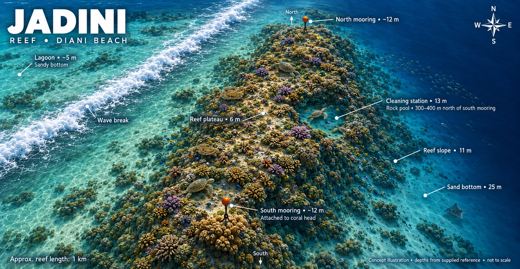
Jadini gently sloping reef dive-site map in Diani All experience levels
Dive site 10

Jadini

Approx. 7–25m Gentle reef slope Coral formations

A gently sloping reef with vibrant coral formations and a varied depth profile. Shallower routes welcome novice divers, while experienced divers can explore more of the slope.

Look for: green and hawksbill turtles, moray eels, nudibranchs, clownfish, surgeonfish and Moorish idols. Whale sharks are possible from October to March; sightings are not guaranteed.
View Jadini briefing →
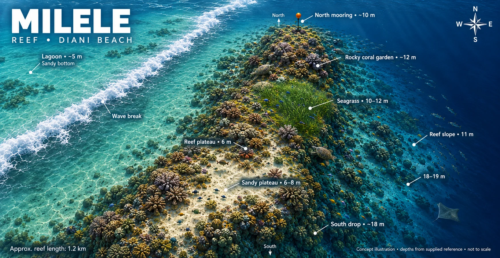
Milele reef map showing sandy plateau, coral gardens and seagrass All Experience Levels
Dive site 11

Milele

Reef plateau Coral gardens Seagrass areas

A varied reef combining sandy plateau, rocky coral gardens and seagrass areas. Ocean Tribe adapts the route and depth to the conditions and the experience of the group.

Best for: exploring different reef habitats and taking time to appreciate the underwater landscape.
View Milele briefing →
See the coastline

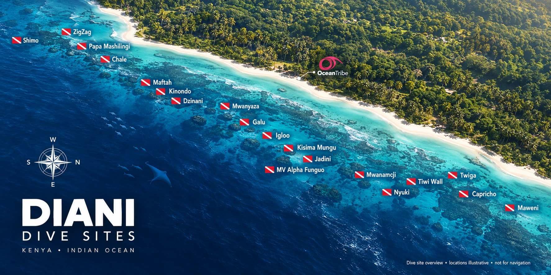
Your Diani dive-site map

See how the local reefs and wreck are spread along Diani’s coastline.

Full map showing Ocean Tribe dive sites along the Diani coast
ℹ️ Boat times are approximate and can change with the departure point, weather and sea conditions. The team will confirm the planned sites during the dive briefing.
What might swim past?

Meet Diani’s underwater residents

From tiny reef specialists to seasonal ocean giants, remember that every encounter is wild and can never be guaranteed.

🐢

Sea turtles

Green turtles are regularly encountered resting, feeding or cruising across Diani’s reefs.

🔍

Macro treasures

Search for nudibranchs, frogfish, pipefish, ribbon eels and leaf scorpionfish.

🐙

Reef characters

Octopus, morays, rays, snapper and colourful reef fish bring every dive site to life.

🦈

Seasonal giants

Whale sharks and manta rays may visit the coast, especially between October and March.

Plan your visit

Marine-life calendar

Use the calendar as a guide to the animals that may be encountered during different parts of the year.

Ocean conditions and wildlife movements vary naturally, so treat every sighting as a special bonus rather than a promise.

Ocean Tribe Diani marine-life calendar shown in full
Your dive day

How the adventure works

The team handles the planning while you focus on enjoying the diving.

1

Tell us about your diving

Share your certification, recent experience and what you would most like to see.

2

Conditions are checked

The team reviews weather, visibility, current and the needs of the group.

3

Sites are selected

The day’s reefs or wreck are chosen to create the best suitable experience.

4

Brief, dive and explore

After a full briefing, head out for two dives along the Diani coastline.

Go beyond the local reefs

Kisite Marine Park

For a completely different adventure, Ocean Tribe also visits Kisite Marine Park. Unlike the regular local two-dive boat trips, Kisite is enjoyed as a full-day dhow experience.

Explore the Kisite trip
Good to know

Diani dive-site questions

Can I choose the exact dive site?
You are welcome to tell the team which sites interest you. The final selection depends on conditions, diver experience, safety and the make-up of the group.
Are there dive sites suitable for beginners?
Yes. Diani has several gentle reef options suitable for less-experienced divers. The team will match the dive plan to your certification, comfort and recent experience.
Can I dive the MV Alpha Funguo wreck?
The wreck is a deeper site generally suited to appropriately certified and experienced divers. Any penetration requires the correct training and must follow the dive team’s plan.
Will I definitely see whale sharks or manta rays?
No wild-animal encounter can be guaranteed. Whale sharks and manta rays may visit the coast, particularly from October to March, but sightings depend on natural movements and conditions.
How long is the boat journey?
Many local sites are approximately 10–30 minutes away. More distant sites, including Tiwi, may take longer. Times vary with conditions and the day’s departure arrangements.
What if I have not dived recently?
Tell Ocean Tribe when booking. Depending on how long it has been and your experience, the team may recommend a scuba-skills update before joining the regular dive trip.
Ready to get salty?

Your next Diani dive starts here

Tell the Ocean Tribe team your certification and experience, then let their local knowledge match you with the right underwater adventure.

Igloo Dive Site- Diani

Diani dive site · Kenya
All dive sites ↗

Igloo.

Rounded coral bommies.
An underwater observatory.
Discover Diani’s distinctive reef architecture.

Book a Diani dive ↗
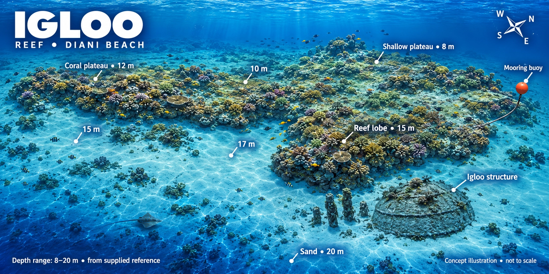
Igloo reef concept map showing coral plateaus, reef lobes, mooring buoy, sandy bottom and the underwater observatory structure. Not to scale.
Your underwater playgroundCoral bommies · Observatory remains · Reef residentsExplore full-size map ↗

Concept illustration, not to scale. The map illustrates 8–20m; the supplied site profile includes deeper routes to approximately 25m. Your guide confirms the planned depth and route for your certification and the day’s conditions.

The upper reefCoral plateauSite profile: around 10–12m
Site profile≈ 25m maximumRoute adapted to certification
The boat ride≈ 10 minutesFrom Ocean Tribe
The starting pointMooring buoyNot normally a drift dive
Follow the reef   ✳   Find the little things   ✳   Dive Igloo
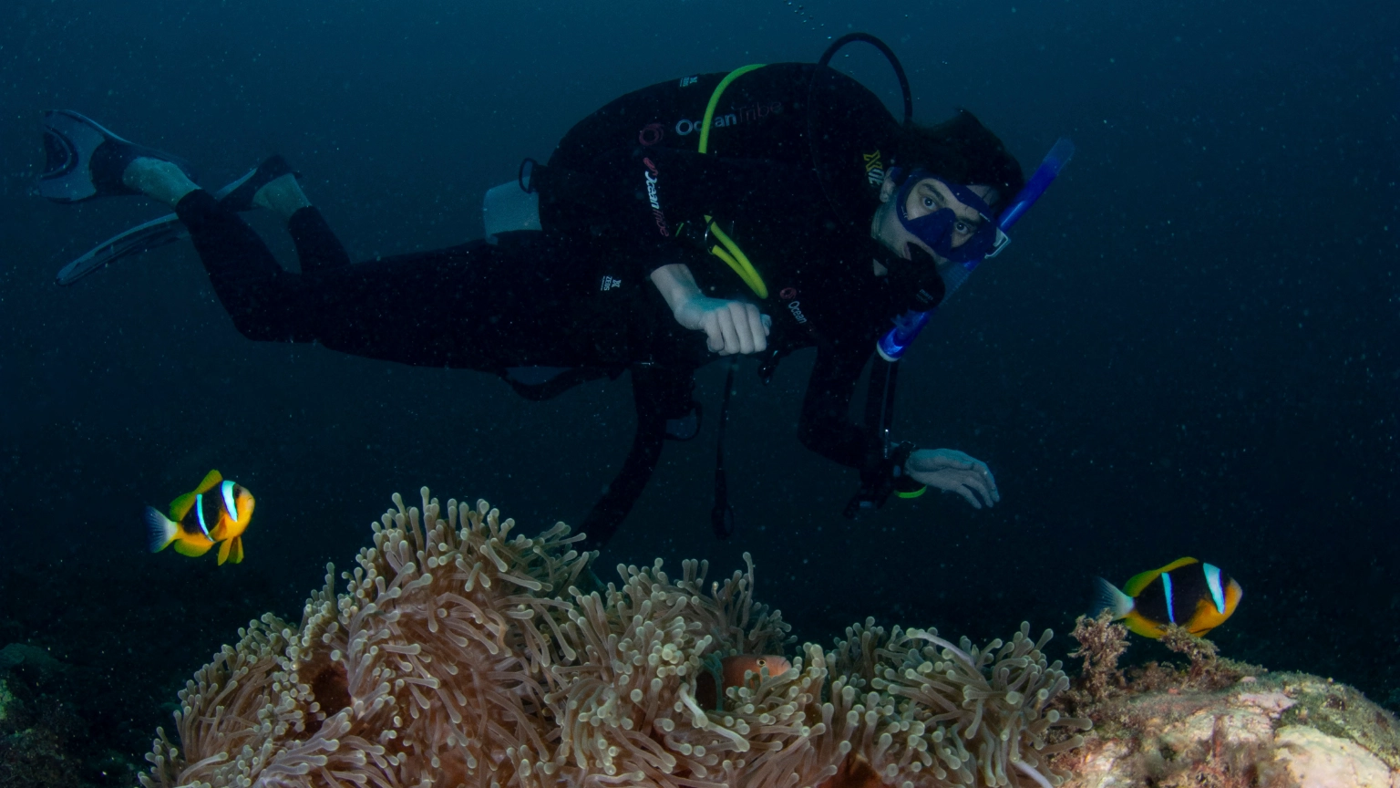
Scuba diver exploring a coral reef
Built by nature Coral domes, reef ledges and swim-throughs.
Coral architecture

One of Diani’s most distinctive reefs

Igloo is located a short boat ride from central Diani, offshore from the Baobab and Papillon Lagoon area and bordered by Robinson Sand Island.

The reef slopes from a coral plateau towards a sandy base. Rounded coral bommies give the site its name and create sheltered spaces, swim-throughs and dramatic underwater photography angles.

1
Dome-shaped coral bommies Hard corals and sponges create Igloo’s signature scenery.
2
An underwater observatory wreck The remains rest on the sand at approximately 20 metres.
3
Big views and tiny discoveries Schooling fish in the blue contrast with excellent macro life.
Follow the reef down

The Igloo depth journey

Your actual route and depth will depend on certification, comfort, current and the conditions on the day.

10m

Coral plateau

Begin around the upper reef, settle your buoyancy and explore the first coral structures.

12m

Reef top

Rounded bommies, hard coral and sponges provide shelter for a busy reef community.

20m

Observatory remains

The wreck of the former underwater observatory rests on the sand beside the reef.

22–25m

Sandy edge

Appropriately certified divers may explore the deeper edge while watching the blue for passing marine life.

Watch before you dive

Igloo dive-site briefing

Preview the reef profile, underwater observatory and key features before heading out on the boat.

🪸 Notice: the shape and position of the coral bommies.
⚓ Look for: the deeper mooring and observatory remains.
🌊 Remember: current and visibility can alter the route.
🤿 Follow: the in-person briefing from your dive guide.
See the whole site

Igloo dive profile

Igloo is a sloping reef with a coral plateau, deeper moorings and a sandy base. The observatory remains provide an additional landmark at approximately 20 metres.

Your guide will select a suitable depth and route for the group. Open Water divers can remain within their certification limit while appropriately trained divers explore deeper sections.

Maximum depth 25 metres
Reef top About 10–12 metres
Water type Salt water
Entry Deep mooring available
Dive style Sloping reef
Boat journey About 10 minutes
Why dive Igloo?

Three dives rolled into one

Reef scenery, an unusual piece of underwater history and excellent marine-life searching all meet at one site.

🏛️

Underwater observatory

Explore around the remains of a former underwater observatory lying on the sandy bottom at approximately 20 metres.

🫧

Swim-through scenery

The rounded coral formations create interesting spaces and dramatic angles for careful divers and photographers.

📷

Wide-angle and macro

Photograph schooling fish and large structures, then slow down to search for tiny animals among the coral.

Who lives at Igloo?

From schooling fish to hidden specialists

Marine-life encounters are always natural and cannot be guaranteed. The slower you explore, the more Igloo may reveal.

Trevally swimming in blue water

Schooling fish

Yellow snapper, fusiliers and trevally may gather around the bommies or hunt in the blue.

Green turtle above a coral reef

Turtles

Turtles regularly pass across the reef or cruise along the sandy edge.

Cuttlefish on a reef

Reef characters

Mantis shrimp, moray eels, squid, cuttlefish and pufferfish may appear around the reef.

Blacktip reef shark

Passing visitors

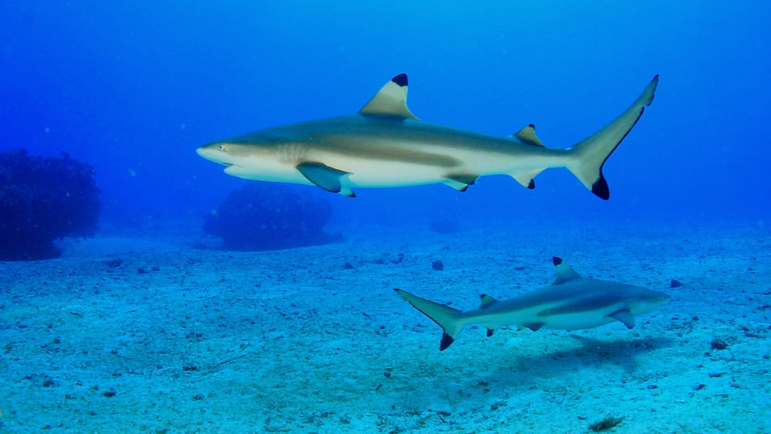
Divers may occasionally see reef sharks cruising beyond the sandy reef edge.

Look closer: search for ghost pipefish, leaf fish, nudibranchs, ribbon eels and cleaner shrimp among the coral.

The habitat: hard coral, sponges, ledges and crevices provide shelter for Igloo’s diverse community.

Is Igloo right for me?

Experience helps when the water moves

Igloo can be suitable for a range of certified divers, but currents may be moderate. The deeper sections, swim-throughs and 25-metre maximum depth require good buoyancy awareness and an appropriate certification.

Your Ocean Tribe guide will assess the conditions and adapt the route, depth and pace to the group.

✓ Good buoyancy Helps protect the coral and makes the structures easier to enjoy.
↘ Watch your depth Remain within the limit of your training and certification.
〰 Current awareness Listen carefully to the guide’s current and entry briefing.
◎ Stay with the group Follow the planned route and maintain contact with your buddy.
QR code and details for logging Igloo in the MySSI app
Save your dive

Log Igloo in MySSI

After the dive, record your actual depth, bottom time and wildlife encounters in your MySSI digital logbook.

✓ Use your dive computer for the actual maximum depth and time.
✓ Add the observatory, coral bommies and marine life to your notes.
✓ Ask your Ocean Tribe professional to verify the dive if required.
Find dive sites in MySSI
Keep exploring

Explore our local reefs and wreck. Swipe through the maps or use the arrows to discover all 11 sites.

Ready to enter Igloo?

Make it part of your Diani dive adventure

Tell the Ocean Tribe team your certification and recent experience. The final sites are selected for the conditions and divers on the day.

Igloo · Scroll across the map on mobile
Full-size Igloo reef concept map with coral plateaus, depth markers, mooring buoy and observatory remains. Not to scale.

Wreck Dive Site Diani- MV Alpha Funguo

Advanced wreck dive · Diani, Kenya
All dive sites ↗

MVAlpha Funguo.

A ship reborn as a reef.
Schooling fish. Hidden discoveries.
Explore Diani’s signature wreck dive.

Book a Diani dive ↗
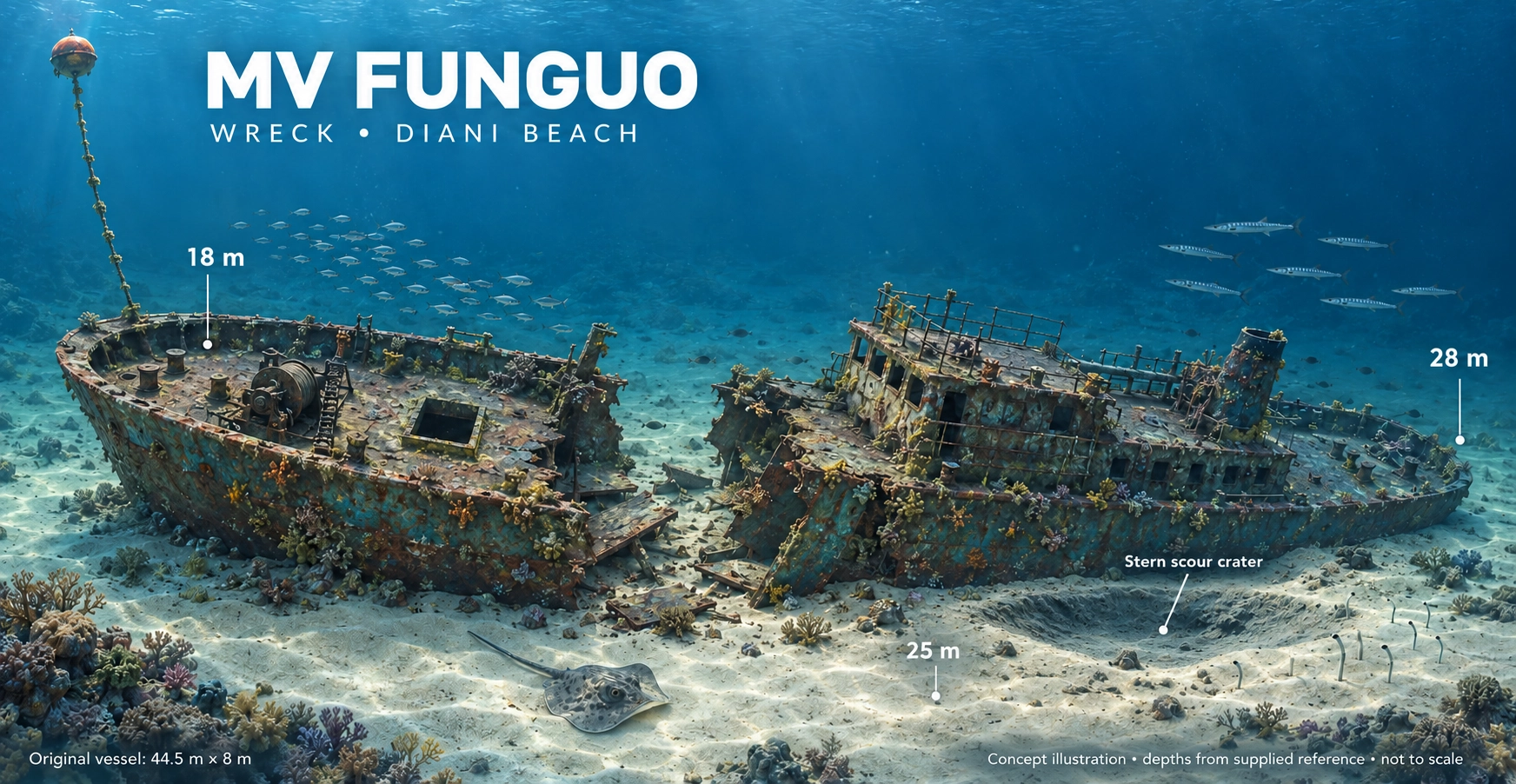
MV Alpha Funguo wreck concept map showing the vessel, mooring line, surrounding seabed, stern scour crater and depth markers. Not to scale.
Your wreck dive starts hereWreck structure · Mooring line · Artificial reefExplore full-size map ↗

Concept illustration, not to scale. Map markers show 18–28m; the supplied site profile lists approximately 22–29m. Your guide confirms current wreck conditions, planned depth and the route for your group.

The experienceAdvanced / deep diveCertification and experience required
Site profile≈ 22–29mA deeper wreck profile
The boat ride≈ 10 minutesFrom Ocean Tribe
The starting pointMooring buoyNot normally a drift dive
Explore the wreck   ✳   Find the little things   ✳   Dive MV Alpha Funguo
A ship reborn as a reef

Diani’s signature wreck dive

MV Alpha Funguo rests on the seabed at approximately 22 to 29 metres. The purpose-sunk vessel has developed into an artificial reef where fish gather around the deck, cargo holds and superstructure.

The wreck sits upright with a slight list. Its recognisable structure makes for an atmospheric external tour, while crevices and sheltered areas provide habitat for fish and smaller reef species.

1
Intact wreck structure Explore the deck, superstructure and cargo-hold areas from outside.
2
Thriving artificial reef The vessel now provides shelter for both schooling fish and macro life.
3
A deeper dive Gas, no-decompression time and depth require careful monitoring.
More than a shipwreck MV Alpha Funguo has become a living part of Diani’s underwater ecosystem.
Know the wreck

Get to know the wreck

Review the wreck’s orientation and key features before watching the full dive briefing.

Wreck profile

Your guide will explain the planned descent, route around the vessel, maximum depth, turning pressure and ascent procedure before entering the water.

Top of wreck Approximately 22m
Maximum depth Approximately 29m
Wreck position Upright with slight list
Access Mooring line
Water type Salt water
Travel time About 10 minutes

Conditions, current, diver certification and recent experience determine the route used on the day.

Watch before you descend

MV Alpha Funguo wreck briefing

Watch the original Ocean Tribe briefing for an introduction to the wreck’s position, structure and normal dive route.

ℹ️ The video is a general site introduction. Your in-person briefing will cover current conditions, the exact route, maximum depth, gas plan, lost-buddy procedure and ascent plan.
Understand the difference

External tour or wreck penetration?

Swimming around a wreck and entering an overhead environment are completely different forms of diving.

🤿

External wreck exploration

Appropriately certified and experienced divers can tour the outside of the wreck while maintaining direct access to open water.

✓ Explore the deck and superstructure externally.
✓ Observe openings without entering the overhead environment.
✓ Monitor depth, gas and no-decompression time carefully.
✓ Remain within your certification and the guide’s plan.
⚠️

Wreck penetration

Entering the wreck creates an overhead environment and requires appropriate wreck training, equipment, techniques and planning.

✓ Correct wreck-penetration certification and recent experience.
✓ Suitable redundant equipment and a continuous guideline.
✓ Specialist gas management and emergency procedures.
✓ A penetration plan approved and led by the dive professional.
Never enter the wreck without the correct training. External certification does not automatically qualify a diver for penetration.
The underwater journey

A typical external wreck tour

The exact route changes with conditions, but a recreational external tour may follow this general progression.

⚓

Descend the mooring

Use the line for a controlled descent while checking your buddy, depth and equalisation.

🚢

Orientate on the wreck

Pause above the vessel to establish the wreck’s position and the route planned during the briefing.

🐟

Tour the structure

Explore the deck, holds and superstructure externally while watching for marine life.

⬆️

Return and ascend

Follow the agreed gas and time limits before returning to the line for the ascent and safety stop.

The wreck is alive

Who lives on MV Alpha Funguo?

The wreck provides food, shelter and hunting territory for an impressive variety of marine life.

Barracuda

Schooling fish

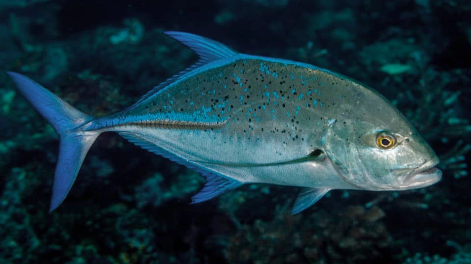
Barracuda, blue-stripe snapper, trevally, jackfish, batfish and kingfish may gather around the structure.

Blue-spotted stingray

Larger visitors

Rays and occasional whitetip reef sharks may pass around the wreck and surrounding seabed.

Grouper

Hidden residents

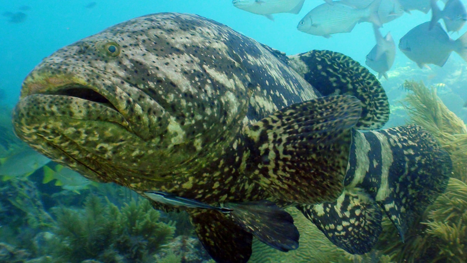
Moray eels, octopus, groupers, lionfish and scorpionfish use openings and sheltered spaces.

Bearded scorpionfish

Macro life

Look closely for nudibranchs, frogfish, bearded scorpionfish and other small wreck specialists.

Marine-life sightings are natural and cannot be guaranteed. Remember to look away from the wreck occasionally—schooling fish often circle in the blue.
Plan the dive

Depth changes everything

At approximately 22–29 metres, good planning and regular instrument checks are essential.

1

Monitor your gas

Gas consumption normally increases with depth. Follow the agreed starting pressure, reserve and turn-pressure plan.

2

Watch your dive computer

Remaining no-decompression time may reduce quickly at wreck depth. Check depth, time and ascent information regularly.

3

Control your buoyancy

Good buoyancy helps protect the wreck, avoids contact with sharp surfaces and prevents disturbed sediment.

MV Alpha Funguo QR code and dive-site information for MySSI
Save the dive

Log MV Alpha Funguo in MySSI

Record the dive you actually completed, including your personal maximum depth, dive time and whether you completed an external tour or a properly trained wreck-penetration dive.

✓ Record your actual depth, time and water temperature.
✓ Add visibility, current and the wreck route used.
✓ Record the marine life encountered around the vessel.
✓ Ask your dive professional to verify the dive if required.
Find dive sites in MySSI
Want to go beyond the outside?

Train as an Advanced Wreck Diver

Specialist training develops the planning, buoyancy, propulsion, guideline and emergency skills needed for properly supervised wreck penetration. Never enter an overhead environment without the required training and equipment.

Explore Advanced Wreck training
Keep exploring

Explore our local reefs and wreck. Swipe through the maps or use the arrows to discover all 11 sites.

Ready to dive the wreck?

Meet MV Alpha Funguo beneath the Indian Ocean

Tell Ocean Tribe your certification, recent experience and wreck-training level. The team will confirm whether the site and planned route are suitable for you and the day’s conditions.

MV Alpha Funguo · Scroll across the map on mobile
Full-size MV Alpha Funguo wreck concept map with vessel structure, depth markers and mooring line. Not to scale.

Kisima Mungu Dive Site- Diani

Diani dive site · Kenya
All dive sites ↗

Kisima Mungu.

God’s Well.
Reef walls, overhangs and open blue.
A Diani adventure for confident divers.

Book a Diani dive ↗
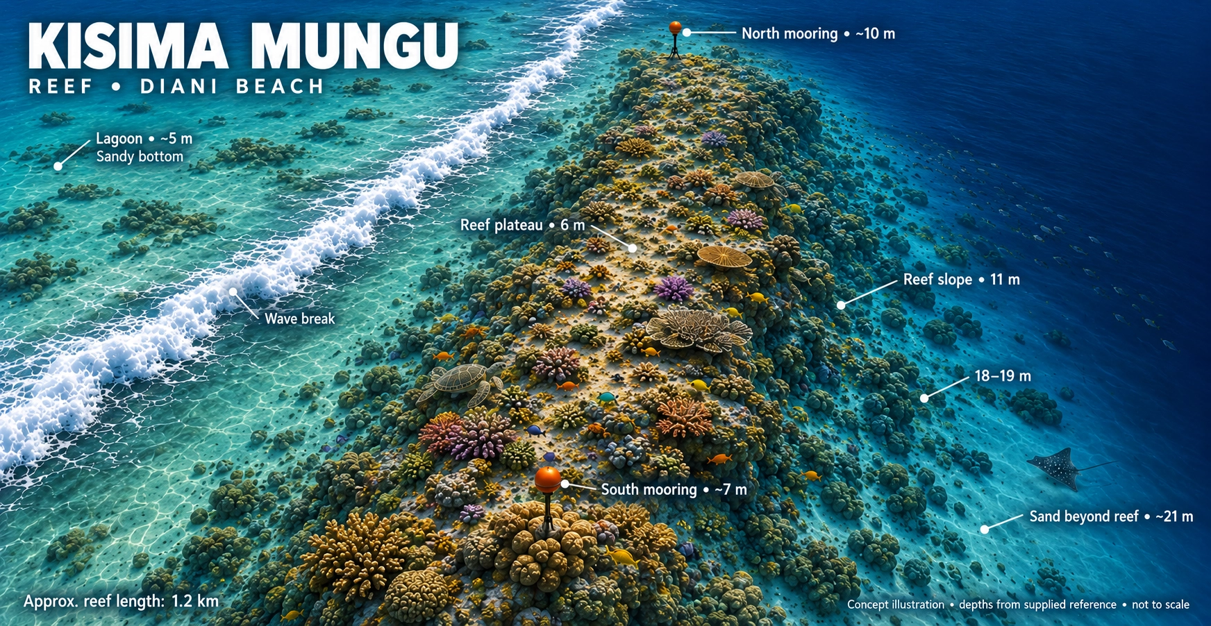
Kisima Mungu reef concept map showing lagoon, coral plateau, north and south moorings, reef slope and sandy bottom. Not to scale.
Your underwater playgroundReef plateau · Moorings · Sandy slopesExplore full-size map ↗

Concept illustration, not to scale. The map labels areas from approximately 5–21m; the supplied site profile describes an upper reef around 14m, planned dives to 25m and deeper sand around 28m. Your guide confirms the route and depths on the day.

The experienceExperienced diversConfidence in depth and current
Site profileUp to 25m plannedReef extends towards ≈28m sand
The boat ride≈ 10 minutesFrom Ocean Tribe
The conditionsMoving waterModerate to strong current possible
Follow the reef   ✳   Find the little things   ✳   Dive Kisima Mungu
A dramatic underwater landscape

Welcome to Kisima Mungu

Kisima Mungu means “God’s Well” in Swahili. The site lies offshore from Diani near Nomads Beach Bar, between the Milele and Jadini reef areas.

The reef rises from deeper sand at approximately 28 metres to an upper edge around 14 metres. Steep walls, overhangs and drop-offs give the site a sense of scale unlike Diani’s gentler coral gardens.

1
Vertical reef terrain Walls, overhangs and drop-offs create dramatic scenery.
2
Big schools and blue water Fusiliers, snapper, trevally and barracuda patrol the reef edge.
3
A dive for confident explorers Depth and current make prior experience valuable here.
Kisima Mungu “God’s Well” · a deep Diani reef adventure
Follow the reef down

The Kisima Mungu profile

The route and depth are adjusted to certification, experience, current and conditions on the day.

14m

Upper reef edge

Begin around the top of the reef and settle into the conditions before following the wall.

20–25m

Walls and overhangs

Explore sea fans, sponges and crevices while watching schooling fish move through the blue.

≈28m

Deeper sandy bottom

The reef extends towards deeper sand, beyond the normal planned maximum for many recreational dive profiles.

Watch before you descend

Kisima Mungu dive briefing

Preview the reef profile and key underwater features before receiving the complete in-person briefing from your guide.

ℹ️ Current strength, visibility and the chosen route can change daily. Always follow the live briefing and maximum depth set by your guide.
Know the site

Kisima Mungu at a glance

Deep and shallow mooring buoys allow the team to choose an entry appropriate to the conditions and divers. Depending on the current, the dive may include movement along the reef edge.

Experience Experienced divers
Planned maximum Up to 25 metres
Reef top About 14 metres
Water type Salt water
Entry Deep and shallow moorings
Boat journey About 10 minutes
The underwater landscape

Built for wide-angle adventure

Kisima Mungu combines vertical scenery, current-fed coral growth and views into open blue water.

↘

Drop-offs

Reef edges descend towards deeper sand, creating impressive views into the blue.

◢

Steep walls

Vertical sections are decorated with sponges, sea fans and whip corals.

⌒

Overhangs

Sheltered spaces provide hiding places for lobster, morays and smaller reef life.

∞

Open blue

Look away from the reef occasionally for rays, sharks and other passing visitors.

What might swim past?

Marine life at God’s Well

Current brings life to the reef, from colourful residents to occasional pelagic visitors.

Red snapper

Schooling fish

Fusiliers and snapper may gather in large schools around the reef edge.

Barracuda in blue water

Hunters in the blue

Trevally and barracuda may patrol beyond the wall looking for feeding opportunities.

Green turtle swimming above coral

Turtles and rays

Turtles, blue-spotted rays, guitar rays and eagle rays may be encountered.

Lobster sheltering in a reef crevice

Wall residents

Search overhangs and crevices for lobster, moray eels and leaf scorpionfish.

Smaller discoveries: nudibranchs, mantis shrimp, boxfish, octopus and cuttlefish reward careful searching.

Pelagic possibilities: grey or whitetip reef sharks and other large visitors have occasionally been reported.

Wildlife is wild and no encounter can be guaranteed. Pelagic sightings are an exciting possibility, not an expected part of every dive.
Are you ready?

A site for confident divers

Kisima Mungu can experience moderate to strong current, particularly around the outer edge. Its depth and terrain make good buoyancy, awareness and comfort in open water especially valuable.

The dive team will assess the conditions and only select the site when it is suitable for the experience and certification of the group.
✓ Good buoyancy Maintain control beside the wall without contacting the reef.
↘ Depth awareness Monitor your computer and remain within your certification limit.
〰 Current confidence Be comfortable following the group in moving water.
◎ Buddy contact Stay close, communicate clearly and follow the guide’s route.
QR code for logging Kisima Mungu in the MySSI app
Save the adventure

Log Kisima Mungu in MySSI

Record the actual route, maximum depth, current and wildlife you experienced in your MySSI digital logbook.

✓ Use your computer for your actual maximum depth and dive time.
✓ Record the current, visibility and entry conditions.
✓ Add the marine life you personally encountered.
Find dive sites in MySSI
Keep exploring

Explore our local reefs and wreck. Swipe through the maps or use the arrows to discover all 11 sites.

Ready for God’s Well?

Take your Diani diving deeper

Tell the Ocean Tribe team your certification and recent experience. Kisima Mungu will be selected when conditions and the group are suitable.

Kisima Mungu · Scroll across the map on mobile
Full-size Kisima Mungu reef concept map with coral plateau, depth markers, lagoon and two moorings. Not to scale.
Learn to Dive Platinum Package

COURSE PACKAGES